Gulf of Mexico
The Gulf of Mexico Basin has proved to be a highly successful hydrocarbon province, and the vast untapped volume of both oil and gas ensures that the basin will continue as a major player for decades to come.
The Gulf of Mexico Basin (GOM) is one of the world’s great petroleum mega-provinces, with a hydrocarbon producing history stretching more than 100 years. Despite its maturity, the Gulf remains one of the most active and successful exploration provinces in North America, attracting numerous domestic and international exploration companies. Giant oil discoveries offshore and expanding tight-sand and shale gas plays onshore maintain the momentum of discovery that will underpin production well into the 21st Century.
More than 230 billion barrels of oil equivalent (Bboe) had been discovered in the Gulf by the early 1990’s. By geologic age, the young Cenozoic fill has proven the most prolific host, yielding 130 Bboe. Next are Cretaceous units, with more than 85 Bboe. Last, but still significant, is the Jurassic section, the oldest rocks in the basin, with 15 Bboe discovered reserves. Current estimates are that another 100 Bboe remain to be discovered.
A large variety of plays
The oil and gas fields are geographically dispersed. In the United States, the northern margins of the GOM in the East Texas and North Louisiana salt basins, the coastal plain from South Texas to Alabama, the broad continental shelf, and the continental slope are all prolific petroleum provinces. In Mexico, major provinces include the Burgos basin to the north and the coastal plains and shelves of Veracruz and Tabasco states.
Exploration plays of the past decade include both geologically young off-shore and old inland targets. Exploration of deep-water Miocene submarine fan sands beneath the north-eastern Gulf yielded multiple 100+ million boe discoveries in the 1990’s that are now being brought on stream. A swath of oil discoveries along the breadth of the modern lower continental slope from Louisiana to the U.S.-Mexican border has focused attention on early Cenozoic submarine fan targets. The play has a potential to yield several billion barrels of oil.
At the other extreme, modern drilling and completion technologies have opened an expanding array of unconventional tight sand and shale gas reservoirs in Jurassic and early Cretaceous strata across the northern, inland, part of the basin, beneath North Louisiana and East Texas.

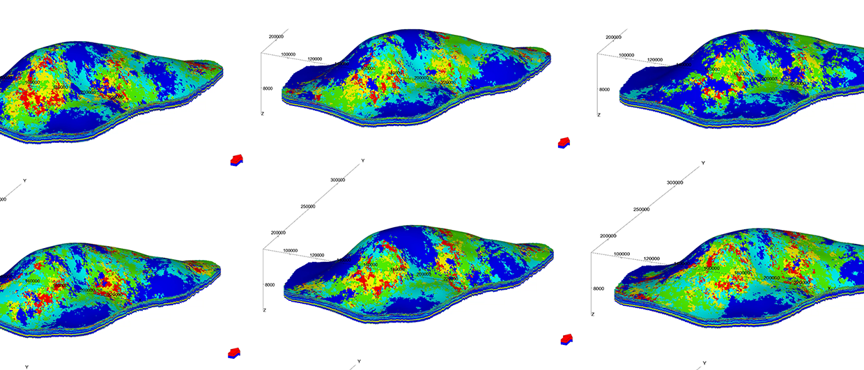
Geologic framework of the Gulf of Mexico petroleum basin illustrates A. Crustal types (T. C. = transitional continental crust; OC = oceanic crust) and depth to the top of the basement, and B. Original distribution of significant thickness of Louann Salt. The salt is absent over oceanic crust. Cartography: Jeffry Horowitz

Geologic elements
What are the geologic elements that combine to create such a large, complex, and long-lived petroleum mega-province? In one sense, the answer is simple: the GOM is both large and geologically complex. Basin classification schemes that have categorized the Gulf simply as a “passive margin” or large “delta” miss this complexity.
I suggest six geologic aspects of the Gulf that have converged to create a “perfect storm” of hydrocarbon productivity.
1. Size:
The Gulf of Mexico is a small ocean basin. Its basement consists of several crustal types, including basaltic oceanic crust, highly stretched continental crust and modestly stretched continental crust (transitional crust, Fig. 1A). Each kind of crust creates different initial basin-floor relief and subsequence response to loading by sediments. Its geologic history extends over 165 million years. Ultimately, large areas of the thin transitional crust and the oceanic crust have subsided to depths exceeding 15 kilometers, creating room for comparably thick sedimentary successions.
2. Oceanographic isolation and arid climate:
The Gulf of Mexico has always lain in the hot, arid subtropics. As a small ocean basin peripheral to the Atlantic, the Gulf has experienced extended geological intervals when connection to the world ocean was restricted. The first, and most dramatic result of aridity and restriction was deposition of widespread salt, the Louann, over much of the basin floor (Fig. 1B). This salt layer formed the foundation onto which subsequent sediment would be deposited. Salt deposition continued for several millions of years, creating a unit as much as several kilometers thick. Later, the arid tropical climate facilitated widespread deposition of limestone on shallow-water platforms whenever clastic sediment supply to the basin was low (Fig. 2, pdf). Later periods of restricted circulation in the Gulf favored burial and preservation of organic matter in marine sediments, setting the stage for formation of rich petroleum source rocks.
3. Convergence of sediment eroded from the large, structurally active North American plate:
During the course of its 165 million-year history the GOM has been the receiving basin for rivers, both large and small, draining much of the North American continent. Initially, remnant Paleozoic mountain belts supplied sediment. As these uplands wore down, topography of the continental interior was repeatedly rejuvenated as the large North American crustal plate moved westward over a mosaic of Pacific Ocean plates. The ancestral Rocky Mountain uplift, Bermuda hot-spot uplift, Laramide Rocky Mountain uplift, and Mid-Cenozoic crustal heating event all created new generations of uplands that in turn shed sediment into the Gulf. In the most recent few million years, climate change has accelerated continental erosion and sediment supply.
4. Development of a well-differentiated shelf, continental slope, and abyssal plain:
By the early Cretaceous, about 130 million years ago, subsidence of the basin-center oceanic crust and deposition along the basin margin had created clearly differentiated shelf, slope, and deep basin regimes. The Late Cretaceous central Gulf was on the order of two kilometers deep. A diverse array of sedimentary environments ranging from coastal plain to submarine fan is recorded in Cenozoic sedimentary units. With high rates of sediment supply, much sediment that included sand, bypassed the shelf margin into the deep basin. Through time, the continental shelf deposits of younger units built out over the slope and abyssal plain deposits of older units (Fig. 3). Thick successions of basinal, slope, shelf, and coastal plain deposits containing multiple reservoir facies, resulted.
5. Geopressurization:
Rapid burial of older, commonly muddy sediment caused build up of fluid pressure within the thick basin fill. This geopressurization decreased mechanical strength of the sediment, facilitating structural deformation. It also generated strong pressure gradients that directed fluids up and out of the deep basin towards the shallow sand bodies of the basin margin.
6. An ongoing history of structural deformation:
 Generalized regional geologic cross section of the northern GOM. Major structural domains are numbered. Drafting: Jeffry HorowitzAlthough originating as a divergent margin basin with an axial spreading center, the Gulf was never tectonically quiescent. Compressional and thermal events caused by the convergence and subduction of Pacific plates beneath North America directly effected the western Gulf margin. There, compressional folds and a foreland trough overprinted the early Gulf deposits and controlled deposition.
Differential pressure gradients created as sediment began to load the Louann caused the salt to flow, creating a range of syndepositional structures including simple rollers, turtles, and salt domes, and complex salt canopies (Fig. 3). In much of the basin, salt was eventually completely expelled from its original position, creating a weld between unrelated rocks. Secondary salt bodies and canopies were themselves loaded and the salt further displaced up and basinward. Thick, isolated sediment pods fill “mini-basins” created by localized salt evacuation from shallow canopies. Stress regimes developed within prograding continental margins created zones of extensional “growth” faulting along shelf margins and compressional anticlines and reverse faults along the slope base (Fig. 3). At the landward limit of Louann Salt, the whole basin fill slipped basinward, creating a regional fault zone (known as the Mexia-Talco in Texas). Both salt and geopressured mudstone provided mechanically weak zones that accommodated horizontal movement and deformation. The long-term result was the wholesale emigration of salt from its depositional location on the floor of the basin upward and basinward into younger strata and even to the seafloor. Along the way a network of remnant faults and welds traverse the entire sediment wedge from its base to top, forming potential conduits for fluid migration.
The petroleum system elements
Source Rocks
Many petroleum basins rely on only one or two principal source rock intervals to generate most of their contained hydrocarbons. The GOM contains multiple, thick, source rock intervals, including Upper Jurassic limestone and marl, Lower Cretaceous marl, lower Upper Cretaceous marl and mudstone and lower Tertiary mudstone (Fig. 2). Cumulatively, these source rocks are dispersed throughout most of the basin’s area.
Importantly, the bulk of the source rocks lie within the lower portion of the basin fill. The widespread accumulation of organic-rich sediment at multiple stratigraphic levels reflects the beneficial interplay of basin isolation and restricted circulation, tropical paleoclimate, development of a deep, often stratified and/or sediment-starved marine basin center, and high rates of terrestrial organic matter input.
Hydrocarbon Generation
The long depositional history and large size of the GOM has resulted in a great diversity of regional burial histories. Mesozoic source rocks of the landward basin margin were buried slowly by younger Cretaceous and relatively thin early Cenozoic sediments (Fig. 3); here petroleum generation progressed slowly in response to burial duration. Basinward, beneath the modern coastal plain and shelf, rapid burial of source rocks led to generation in the early to middle Cenozoic. Beneath the late Cenozoic outer shelf and continental slope depocenters, deep burial brought source rocks into oil and gas kitchens only within the last few million years. The overall pattern of basinward advancing deposition illustrated in the regional dip cross section (Fig. 3) created successive waves of maturation of source rocks. The result was multiple petroleum systems whose peak generation times spanned the 65 million years of the Cenozoic and continue today.
Migration
It has long been recognized that the principal GOM source rocks lie far beneath the center of mass of reservoired hydrocarbons. Large-scale upward migration of thousands of meters is commonly required, especially in the Cenozoic reservoirs that contain the bulk of the oil and gas. Here, structures created by the long history of gravity tectonics acting on the salt and overpressured mudstone have played a critical role. Faults, salt bodies, and welds created pathways that extend through source rocks many kilometers into overlying Cenozoic sediments (Fig. 3). The long history of formation and reactivation of these growth structures provided condiuts that were ready and available when pulses of peak generation provided a charge of movable hydrocarbons.
Reservoirs
The long history of deposition in the Gulf, with multiple rock types ranging from dolomite and limestone and highly cemented sandstone and mudstone to unconsolidated sand and mud, and depositional environments from carbonate platforms and reefs to deep-marine submarine fans has provided a multiplicity of potential reservoirs. Petroleum has been found and produced from every major stratigraphic unit from the Jurassic Norphlet age eolian siltstones and Smackover age shallow-water limestones directly above the Louann to Pleistocene turbidite sands of the modern continental slope (Fig. 2). Porosity types range from simple intergranular pores to secondary leached pores in deeply buried, highly cemented sandstones. Jurassic and Cretaceous carbonate reservoirs commonly exhibit fracture porosity. As conventional reservoirs have been exploited onshore, effort has successfully shifted to unconventional reservoirs, including fractured chalk (Austin), tight sand (Cotton Valley-Hosston), and shale (Bossier). Here, source rock and reservoir can be intimately mixed.
The pattern of Cenozoic continental margin progradation due to the high rate of sediment supply placed a succession of reservoir systems one on top of the other. Unlike many basins, storage space for sediment on the basin margins was quickly filled by rapid sediment supply through multiple rivers. Coastlines prograded to and over the shelf edge much of the time, transporting sand directly to the upper slope and into the deep basin. Sandy submarine fans were overlain and buried by continental slope turbidites. Slope sands were commonly trapped and ponded within intra-slope basins and troughs created by salt evacuation and extensional faulting. In turn, delta and shore-zone sand bodies prograded across the shelf and over the continental slope succession. Many of these depositional systems, such as submarine fans and coastal barrier bars, created naturally isolated reservoir systems that efficiently retain hydrocarbons. Syn-depositional and post-depositional structural deformation further disrupted sand-body continuity, enhancing retention potential.
The high rates of sediment supply and rapid subsidence resulted in vertically stacked sand bodies with depositional patterns repeated tens of times over kilometer-thick successions; multistory reservoir systems are a characteristic feature of GOM Cenozoic petroleum fields. The thick, repetitious sand successions provide immense available pore volumes. Thus, Gulf reservoirs are commonly under-filled. The widespread development of overpressure further increases productivity of many reservoirs.
Traps and Seals
The GOM is a mud-dominated basin. Seals are abundantly interleaved with potential reservoir facies. The complex depositional and structural architectures combine to create a diverse array of trap types. A short list of important trap types include basement structural highs, primary salt domes and turtle anticlines, growth faults and roll-over anticlines, complex faults, folds and discontinuities associated with salt canopies, basin-floor fold and thrust belts, sub-unconformity truncations, facies changes, and terminations against salt.
Like reservoir successions, structural features of the Gulf display great vertical extent (Fig. 3). The interplay between syn-depositional deformation and deposition enhanced the vertical stacking of reservoirs in the trapping structures. In general, the GOM may be thought of as a high-impedance basin. Pathways up and out of the very thick, structurally compartmentalized basin fill are laced with detours, delays, and dead ends.
A multitude of possibilities
The Gulf of Mexico basin is a contradiction: a highly mature petroleum province that continues to yield new frontier plays.
Over much of the basin, drilling has penetrated only the upper one-half to two-thirds of the sediment column. Exploration of complex structures beneath canopies is in its infancy. Discoveries beneath the deep continental slope argue for the presence of thick sand-rich intervals in this untested section. Deep-water Jurassic and Cretaceous objectives of the eastern Gulf remain largely undrilled, as does much of the continental slope of the western Gulf.
Technologic advances and changing energy economics, together with this vast untapped volume of demonstrably hydrocarbon-rich basin fill ensure that the GOM will continue as a major player for decades to come.
Acknowledgements
Thanks to the member companies of the Gulf Basin Depositional Synthesis Project for continued research support. Jeffry Horowitz drafted original figures.