“Everyone says that their part of the world is the final frontier – but believe me, the Arctic really is,” says Al Fraser, EGI Professor of Petroleum Geology at Imperial College in London, and former Exploration Manager involved in BP’s circum- Arctic project since 2002. “It’s the last place we can expect to find significant oil and gas reserves, with approximately 200 Bboe already discovered, and USGS estimates of 114 Bbo, 2,000 Tcfg and 44 Bb of natural gas liquids yet to be found (Gautier et al., 2009). Looking at the way in which the Earth’s rapidly increasing population is eating into our discovered reserves, we need new sustainable oil and gas developments, and the Arctic is one of the few places we will find them.”

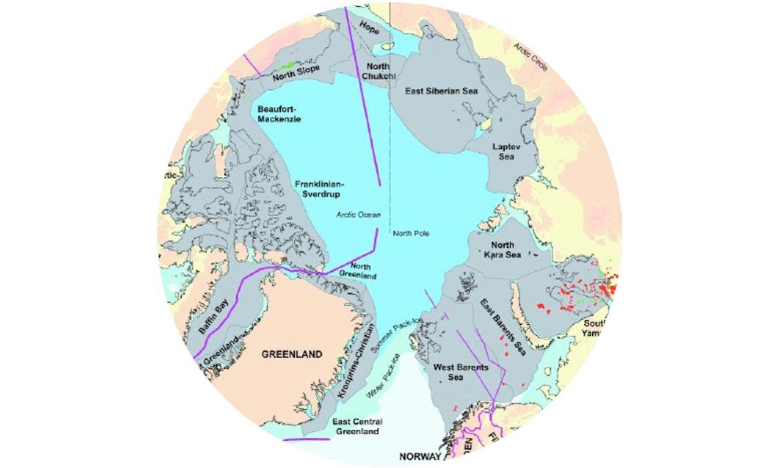
About 50% of the Arctic Ocean is continental shelf, much of it in less than 50m water depth. There are two deepwater basins floored to some extent by oceanic crust, the Eurasia Basin and the Amerasia Basin, separated by a thin sliver of continental crust comprising the Lomonosov Ridge. Source: Jakobsson et al.
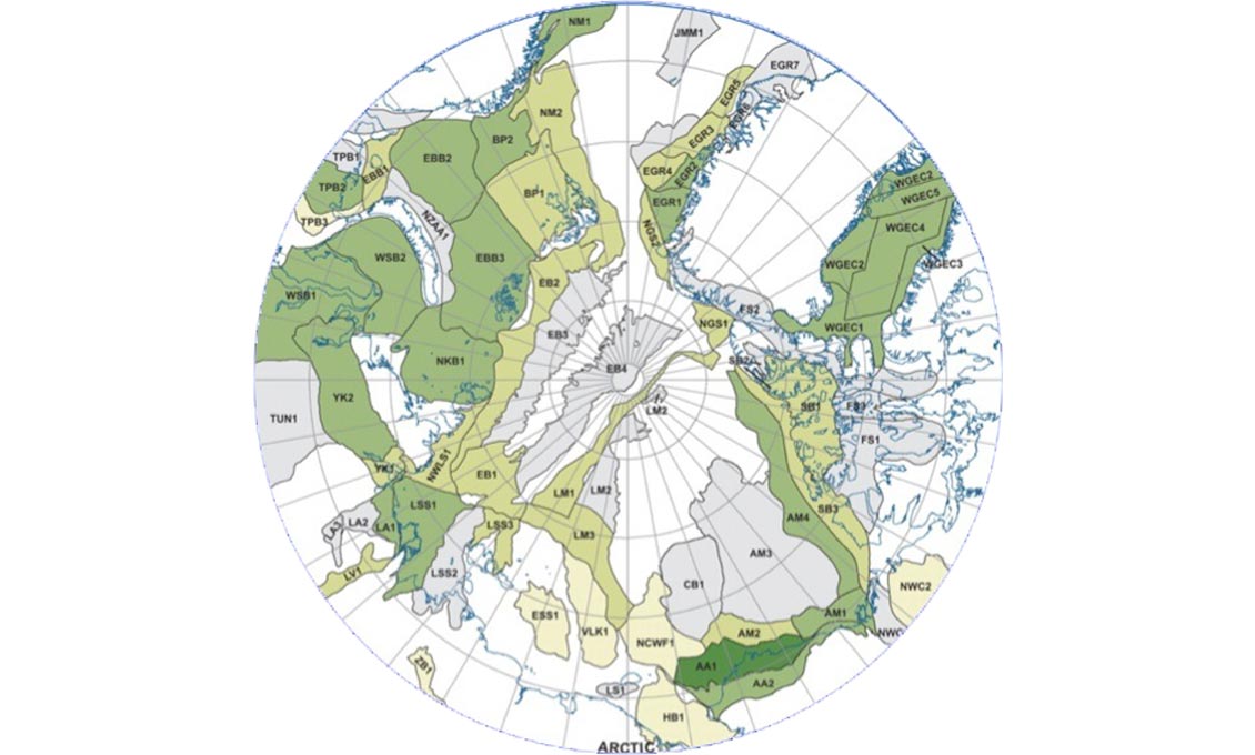
Arctic Undiscovered Oil (USGS, colour-coded for mean estimated undiscovered volumes). Source: D L Gautier et al.
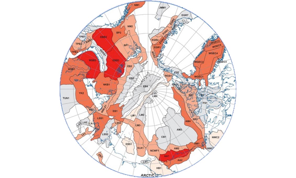
Arctic Undiscovered Gas (USGS, colour-coded for mean estimated undiscovered volumes). Source: D L Gautier et al.
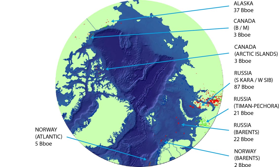
Five countries hold major interests in the Arctic – Russia, USA, Canada, Norway and Greenland – and as interest in the region increases, access opportunities have become increasingly available. A few areas, like Alaska, have been explored for decades, while others, such as East Greenland, are only just seeing the results of their first deep seismic surveys. Discoveries are focussed geographically, reflecting access rather than resources, with most so far having been made off West Siberia and the South Kara Sea (90 Bboe) and Alaska (40 Bboe). Vast areas remain unexplored, including a 5,000 km long swathe of shallow continental shelf from the North Chukchi Basin to the North Kara Sea.
In fact, the vast Arctic Ocean region, which covers over 14 million square kilometres, has the most extensive continental shelf area of any ocean basin. “Remove the ice and the Arctic is 50% continental shelves, much of it in less than 50m water depth,” Al says. “The shelf of the Alaskan margin is relatively narrow when compared to the broad expanses of unexplored shelf off Russia, which includes the Lena Delta, arguably the largest unexplored delta in the world, and known to contain up to 15 km of Tertiary sediments.”
Plenty of Potential
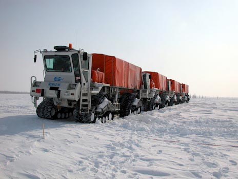 Vibrator trucks at work in West Siberia. Source: John Simmons, ON CommunicationsThe geological map of the Arctic is dominated by two major spreading centres: the Eurasia Basin – the northwards continuation of the North Atlantic Ridge – and the Amerasia Basin, which are separated by the thin continental sliver of the Lomonosov Ridge. Cretaceous ocean crust is likely to floor most of the Canadian portion of the Amerasia Basin, but the region around the Alpha and Mendeleev Ridges, thought to be a mixture of extended continental crust and igneous province, is still unclear. Regional knowledge suggests that the Eurasia Basins started to experience spreading in the Early Eocene, with Greenland moving away from Norway, as the Lomonosov Ridge moved away from the Barents-Kara margin. At a later date the two oceans rejoined, allowing anoxic conditions to prevail in the Arctic Ocean throughout most of the Palaeogene. Baffin Bay is thought to have also experienced Paleogene spreading, but the timing is not proven. “Understanding the distribution of oceanic versus extended continental crust is vital,” Al explains. “It is key to tectonic model assessment and thus to understanding the true potential of the region.”
“For a good working petroleum system, four main factors are always required. World class source rocks; sufficient heat flow for oil generation and migration; excellent reservoirs such as thick, permeable sandstones and major deltas and carbonate platforms; and giant structures sealed by mudstones or salt. I believe that these are all present in many different formats throughout the Arctic.”

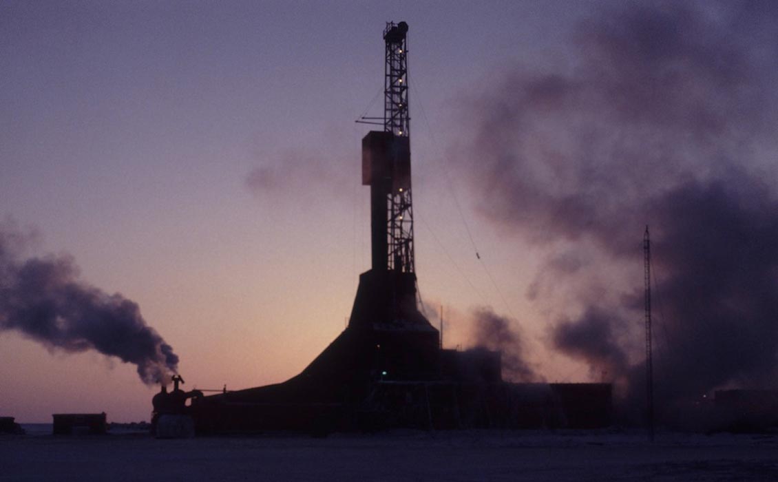
Working in the Arctic presents many challenges. Source: John Simmons, ON Communications
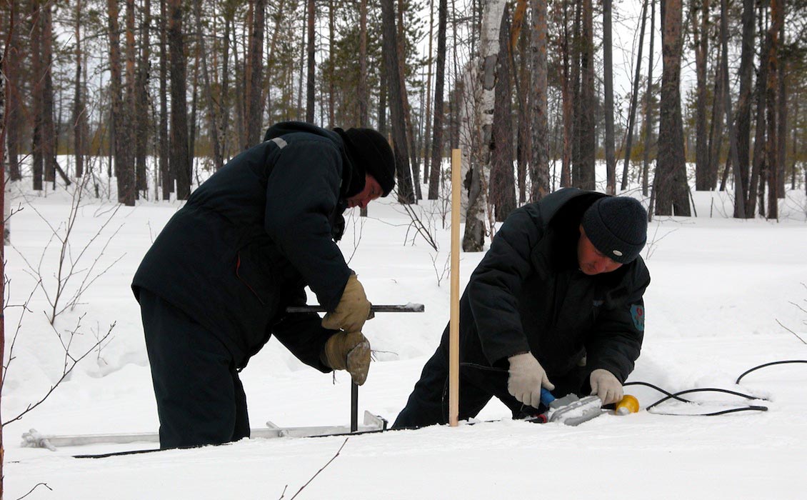
Working in the Arctic presents many challenges. Source: John Simmons, ON Communications
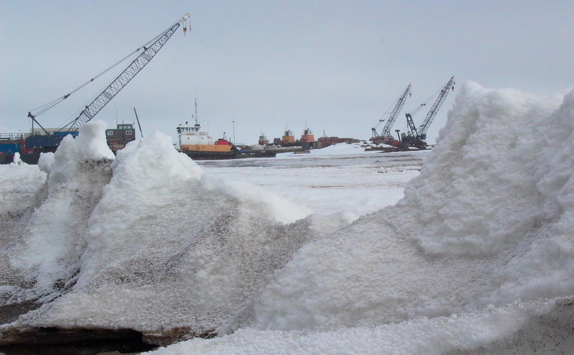
Working in the Arctic presents many challenges. Source: John Simmons, ON Communications
“The key source rocks are the Triassic Shublik Formation, the Jurassic Bazhenov and the Cretaceous HRZ, as well as the Devonian Domanik in the South Barents Sea and Timan-Pichora, all of which were deposited in large anoxic epicontinental seas. The Tertiary has major regional source rock implications, as the period after the Palaeocene-Eocene thermal maximum was the last time the Arctic Basin was enclosed. It experienced high temperatures, rainfall and runoff, an atmosphere rich in carbon and nitrogen, and major growth of azolla, a free floating freshwater fern and the fastest growing organism on the planet (see GEO ExPro, Vol . 4, No. 4). Key to success in the Arctic will be prediction of world class regional source rocks.”
“During the Permian, there was widespread development of a broad carbonate platform throughout the extensive continental shelf area running from the Barents Sea anticlockwise to the Offshore Alaska with additional excellent reservoirs in the Triassic of Prudhoe Bay and Triassic and Jurassic in the Barents Sea. There are also the huge Tertiary Mackenzie and Lena Deltas which offer vast unexplored potential.”
“The resources are there – it’s extracting them that presents the challenges.”
Exploring Under the Ice
So what are the important issues ahead of us in the search for Arctic hydrocarbons?
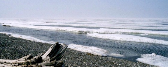
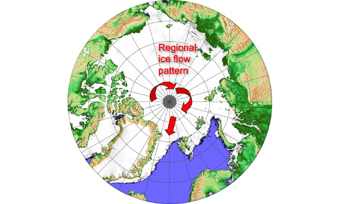
“Well, obviously, there’s a lot of ice in the Arctic – but its distribution varies from year to year,” Al says. “We need to fully understand the constraints. The ice is reported to rotate clockwise at a rate of up to 3 m/hr and exits the Arctic into the North Atlantic through Baffin Bay and between Greenland and Iceland, producing hazardous icebergs (as the Titanic found out to its cost) which will hinder data acquisition and any future drilling. Also, the Arctic shelf is very broad and very shallow; water depths over most of the Chukchi Sea, for example, are less than 200m, much of it less than 20m. The mobile ice presents a set of challenges to economic exploration, drilling and development that we currently have no idea how to overcome. Of course, such things were said about exploring in deepwater just over 20 years ago, and look at the progress we have made there.”
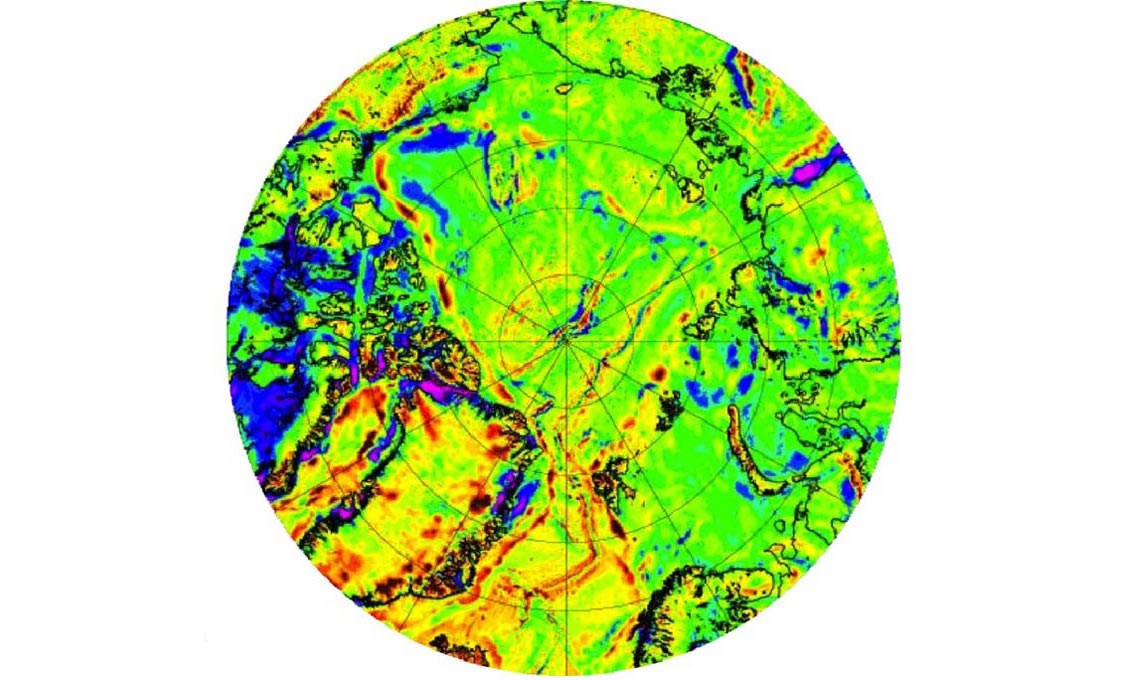
Free-air Gravity and Ocean Crust model. This map of free-air gravity (compiled by Arctic Gravity Project) helps to define the areas of oceanic crust. The spreading centers of the N Atlantic and the Eurasia Basin are evident. The areas of Tertiary (pink)and Cretaceous (green) ocean crust around the spreading ridges are flanked by the highly extended continental crust of the predominantly unexplored passive margins. Much of the intracratonic basin area extending landwards from the passive margins has experienced basement-involved compression, forming gentle anticlinal folds, which create the traps for some significant Arctic gas fields. Two major deltas are located at the tip lines of the two spreading centres and flanked by the Pacific Rim foldbelt – the Mackenzie Delta and the Lena Delta.
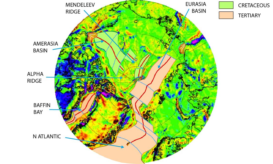
Free-air Gravity and Ocean Crust model. This map of free-air gravity (compiled by Arctic Gravity Project) helps to define the areas of oceanic crust. The spreading centers of the N Atlantic and the Eurasia Basin are evident. The areas of Tertiary (pink)and Cretaceous (green) ocean crust around the spreading ridges are flanked by the highly extended continental crust of the predominantly unexplored passive margins. Much of the intracratonic basin area extending landwards from the passive margins has experienced basement-involved compression, forming gentle anticlinal folds, which create the traps for some significant Arctic gas fields. Two major deltas are located at the tip lines of the two spreading centres and flanked by the Pacific Rim foldbelt – the Mackenzie Delta and the Lena Delta.
Oil and gas – fields and resources. Total = 140 billion barrels (oil equivalent). Source: Laherrere 2008
Arctic oil and gas fields from IHS.
Wells offshore only.
Ice summary. Source: Spreen, G., Kaleschke, L., and Heygster, G. (2008), Sea ice remote sensing using AMSR-E 89 GHz channels, J. Geophys. Res., doi:10.1029/2005JC003384
“A seasonal approach to exploration is obviously essential, but we also need to understand the climatic changes the region is experiencing,” he continues. “In Alaska and Western Canada the average winter temperatures have increased by as much as 4°C over the past 60 years. No one had tackled and survived the famed North West Passage (the Arctic sea route linking the Atlantic and Pacific Oceans) until Amundsen’s three year expedition at the beginning of the last century. Now it can be done in a few days, through waters that were previously permanently icebound. This has major implications for seismic acquisition, exploration drilling and ultimately for the development of production facilities.”
A further challenge is the sparseness of the existing database, particularly for regional seismic and wells in the high Arctic, with drilling clustered in a few regions, and large areas or the Arctic relatively poorly understood. The seismic database is gradually increasing, however, spearheaded by improvements in the technologies being used by the seismic companies, such as methods of shooting marine seismic under the ice, as well as improving methods of land seismic acquisition.
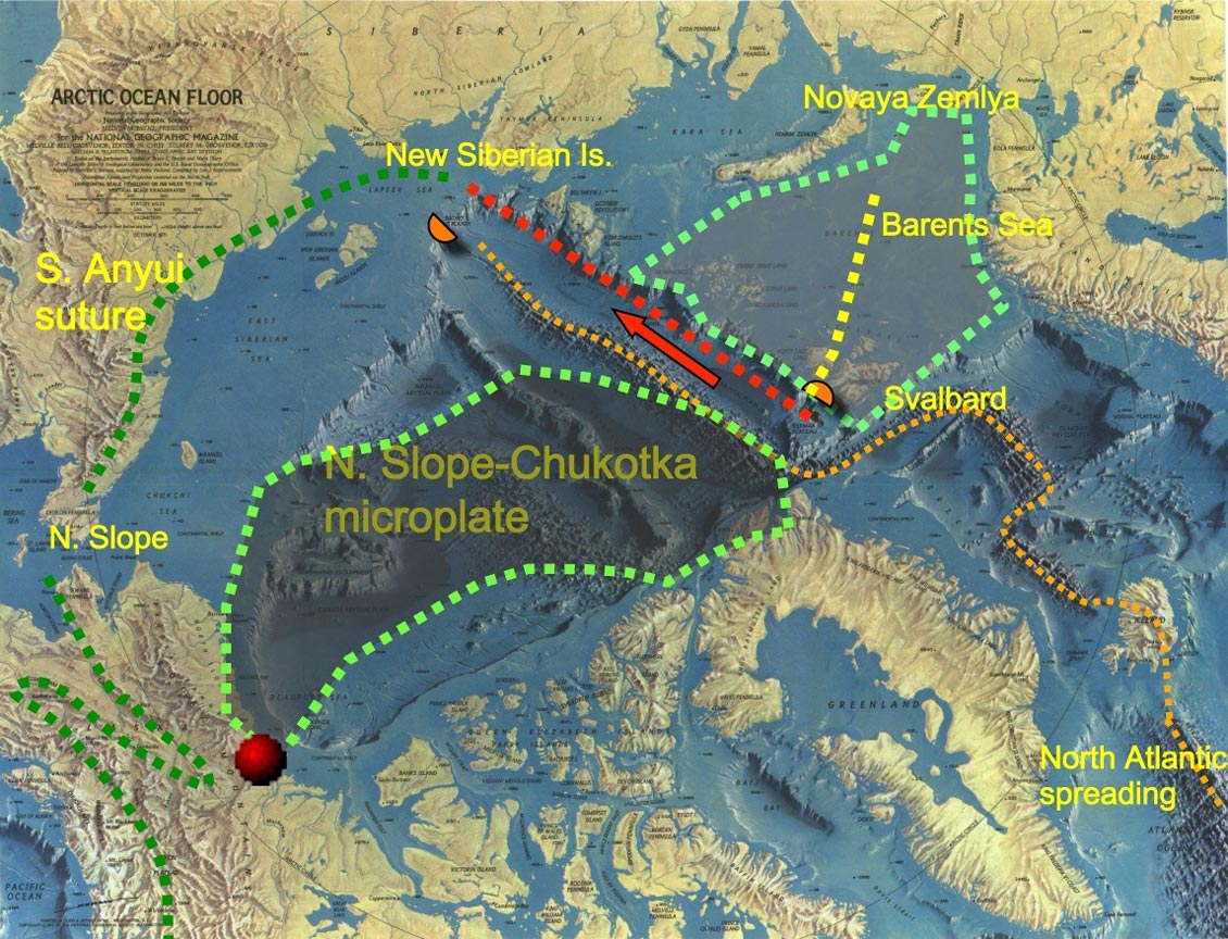
The Big Windscreen Wiper model. Map: National Geographic.
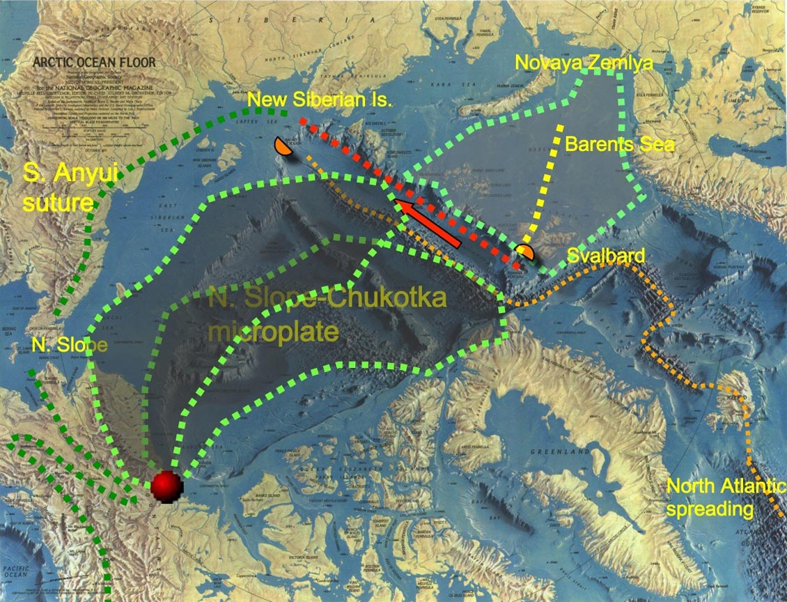
The Big Windscreen Wiper model. Map: National Geographic.
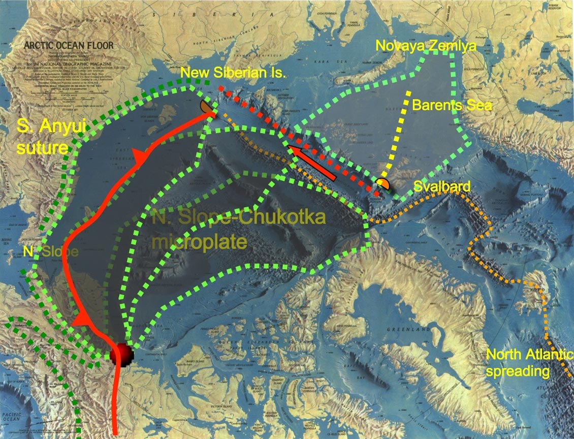
The Big Windscreen Wiper model. Map: National Geographic.
Sustainable Development?
Looking ahead, however, Al thinks that dramatic innovations in technology will also be required in order to drill and produce in the Arctic. “In the South Kara Sea only two structures have been drilled, and both are large gas discoveries – Russanovskoye and Ldeningradskoye. They are sitting there under the ice, waiting for us to work out how to produce from them. We need to find techniques for both drilling and producing below the ice flow. I expect these will involve using downhole methods, with subsurface hydrocarbon separation and conversion all occurring in the well, producing hydrogen and syngas to the surface as the energy source. These are the technologies we are going to have to think about – and they are actually already working on the test bench at Imperial College.”
“The Russian program for oil production in the Arctic includes one scheme to use a manned nuclear-powered drilling submarine that can move between wells, attached to a fixed frame on the sea bottom.” The prospect of nuclear-powered drilling submarines, of course, brings us to another major issue: the environment. The Arctic is a pristine wilderness, probably the last one left on earth. Many are completely opposed to hydrocarbon exploration and production in the area. All exploration and development plans have to take into account this opposition, and undertake all possible measures to prevent risk to the environment.
 Source: Alastair Fraser“There are many conflicting interests involved in Arctic exploration,” Al says. “The environmentalists represent one facet, while governments can denote a number of different viewpoints. For one country, exploration for oil in their waters presents important development opportunities, and for somewhere like Greenland, possibly independence. Other decision makers will have their eye on energy security – or the next election. And we must not forget that about four million people live in the Arctic, 15% of whom are indigenous peoples who see nature as a long term resource which must be protected. Finally, of course there are the oil companies, often driven by short term shareholder value and demands.”
“Sustainable development will require real partnerships between governments, industry and indigenous peoples, requiring a consistent approach across political boundaries.”
A Striking Paradox
 Professor Alastair J. Fraser. Source: Imperial College / Layton ThompsonIn summary, Al reiterates that the Arctic is a major hydrocarbon province, with many potential oil and gas reservoirs throughout the region just waiting to be exploited, particularly in the extensive passive margins and associated deltas. Despite avid discussion between many nations about the environmental and sustainability issues involved in Arctic exploration, he points out that it is Russia, already holding three-quarters of the discovered reserves in the Arctic, who will control future Arctic energy resources.
“And this is not going to happen quickly,” he adds. “Despite technological advances, estimates of timing to production have not changed in ten years – it will take a long time and there are many, many challenges ahead.
“There’s a striking paradox here,” he points out. “We are facing new industrial challenges as the Arctic is warming due to the products of the very same industries that are now entering the Arctic regions. This has not only global implications, but also very concrete local and regional effects.”
Professor Alastair J. Fraser holds the EGI Chair in Petroleum Geoscience at Imperial College, London. He worked for BP as a Petroleum Geologist/Exploration Manager for over 30 years in a career that took him to most corners of the world. Following the BP Amoco merger, he led the team which made the significant Plutonio discovery in Block 18, deepwater Angola. He is the author of many papers on the petroleum geology of extensional basins, most notably on the North Sea Jurassic and northern England Carboniferous.
References:
Gautier D., Bird K. J., et al. (2009) Assessment of Undiscovered Oil and Gas in the Arctic. Science 324:1175–1179.
Spencer, A.M., Embry, A.F., Gautier, D.L., Stoupokova, A.V. and Sorensen, K. (2011), An overview of the petroleum geology of the Arctic. Geological Society, London, Memoir 35, 1-15.
Grantz, A, Scott, R.A., Drachev,, S.S., Moore T.E. and Valin, Z.C. (2011). Sedimentary successions of the Arctic Region (58–64° to 90°N) that may be prospective for hydrocarbons. Geological Society, London, Memoir 35,17-37
Jakobsson, M., R. Macnab, L. Mayer, R. Anderson, M. Edwards, J. Hatzky, H. W. Schenke, and P. Johnson (2008), An improved bathymetric portrayal of the Arctic Ocean: Implications for ocean modeling and geological, geophysical and oceanographic analyses, Geophysical Research Letters


